HOME PAGE
WHAT'S NEW?
JUNIOR PAGE
COACHING
WHAT IS
ORIENTEERING?
GALLERY
MAPPED AREAS
EVENTS DIARY
RESULTS
SOLUS
CLUB POLICIES
HOW TO JOIN
LINKS
COMMENTS FORM

THE HEADLESS CHICKEN PAGES
Hills Wood

Grid Reference NX 929 731
Surveyed and mapped in 1986. Transferred onto OCAD 2013.
Owned by Forest Enterprise and private land owners.
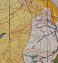
The Hills Wood map covers an area of well-contoured, open grazing land, bordered on the north and west by fields and a small wood at the eastern end. The map was first used for the Scottish Relay Championships in 1986 and was later used for colour-coded events. Because of its close proximity to Dumfries, Hills Wood has been popular for summer evening events.