HOME PAGE
WHAT'S NEW?
JUNIOR PAGE
COACHING
WHAT IS
ORIENTEERING?
GALLERY
MAPPED AREAS
EVENTS DIARY
RESULTS
SOLUS
CLUB POLICIES
HOW TO JOIN
LINKS
COMMENTS FORM

THE HEADLESS CHICKEN PAGES
Castle Douglas Street Map
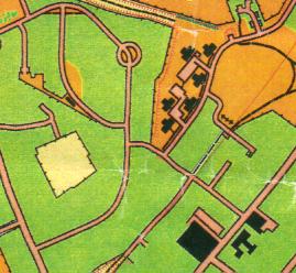
Grid Reference NX 764 618
Produced on OCAD in 2001.
Castle Douglas town is laid out with plenty of grassy areas around the houses. Hence this is a street map with the potential for courses with many legs that minimise time on pavements. There are also plenty of alleys that create route choices. Street O here is a challenge.
@ Crown Copyright. All rights reserved. PU 4342U. BOF Map registration number:- SO-01-351